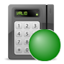
| Access control unit |
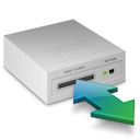 - Access control unit is
Online. - Access control unit is
Online. - Access control unit is
Offline. - Access control unit is
Offline. - Access control is showing a
Warning. - Access control is showing a
Warning.
|
- Monitor the access control unit status.
|
| Alarm |
 - Inactive alarm - Inactive alarm - Active alarm - Active alarm- Semi-transparent polygon or ellipse that matches the color of the alarm and
flashes if the alarm is active.
- A map object linked to
an active alarm is flagged with an alarm notification
bubble that has the same color as the alarm.
- If Display alarms from linked maps is enabled in the
Map section of the Operation desktop options, the number
of active alarms on a linked map is shown on the Maps task
toolbar, floor controls, and links to that map.
|
- Show alarms on maps, lets you investigate, acknowledge, snooze, or forward the
alarm, and lets you review the alarm procedure.
- Useful when no entities attached to the alarm are represented on maps.
- Click the notification b
- Point to the bubble to show more details.
- Click the notification bubble to replace it with a tile bubble.
- (Inactive) Click to trigger the alarm manually.
- (Active) Click to display the alarm in a tile bubble.
|
| ALPR unit (federated only) |
 - Fixed ALPR unit - Fixed ALPR unit - ALPR unit is in maintenance
mode. - ALPR unit is in maintenance
mode.- Reads and hits are shown in notification bubbles.
|
- Monitor the reads and hits from federated ALPR cameras.
Tip: To monitor live video from the associated context camera, enroll
the ALPR unit as a video unit and create a separate map object for the
camera.
|
| Area |
- Map thumbnail (always linked to the map that it represents)
- Colored semi-transparent polygon or ellipse (optionally linked to a map)
|
- Point to show people count or people presence, if enabled.
- Remove selected cardholders from the area.
- Click to display the area or map in a tile bubble, or to switch to a linked
map, if defined.
|
| Automation |
 - Manual automation - Manual automation - Scheduled automation - Scheduled automation - Event-based automation - Event-based automation
|
- Click the automation icon, and then click Play to run
the response actions associated with the automation.
|
| Camera |
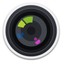 - Camera isn’t recording. - Camera isn’t recording.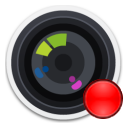 - Camera is recording. - Camera is recording. - Camera detected motion (with
green ripple effect). - Camera detected motion (with
green ripple effect). - Camera is in maintenance
mode. - Camera is in maintenance
mode.- Fixed cameras are shown with a blue field of view (FOV).
- PTZ cameras are shown with a green FOV.
|
- Monitor alarms and camera events.
- Click to view live or playback video in a tile bubble.
- If the camera supports position feedback, click and drag the FOV to pan and
tilt.
- Use the PTZ widget to zoom in and zoom out.
- Click the map while holding the Ctrl key to point all available cameras to
that location.
|
| Camera sequence |
 - Camera sequence - Camera sequence
|
- Display multiple cameras in a single tile bubble.
- Point PTZ cameras to a specific location.
- Double-click the camera sequence to display all the cameras in separate tiles
in the Monitoring task. If the map is displayed in a tile,
it isn’t replaced if the tiles are full.
Note: The Locate me right-click command finds individual
cameras in the camera sequence, not the camera sequence itself.
|
| Cluster bubble |
 - Three or more map objects,
when placed too closely to be visible at a given zoom level, are represented by
a blue cluster bubble. The bubble shows the number of the objects inside
it. - Three or more map objects,
when placed too closely to be visible at a given zoom level, are represented by
a blue cluster bubble. The bubble shows the number of the objects inside
it.Note: The count of clustered objects uses the following group sizes: 3, 4,
5, 10, 20, 50, 100, 200, 500. Counts in between these sizes, or larger, are
indicated by a plus sign (+).
|
- Click to zoom in on the map to view the individual map objects.
|
| Door |
 - Door open - Door open - Door closed and no lock is
configured - Door closed and no lock is
configured - Door closed and locked - Door closed and locked - Door closed and
unlocked - Door closed and
unlocked - Door forced open - Door forced open - Door unlocked and in
maintenance mode - Door unlocked and in
maintenance mode - Door unsecured - Door unsecured- Events are displayed in
event notification bubbles. The color of the bubble
matches the color assigned to the event.
|
- Monitor alarms, door states, and events.
- Point to the bubble to show more details.
- Click the notification bubble to replace it with a tile bubble.
- Unlock the door, override the unlock schedule, shunt the reader, and shunt
inputs by using the Door widget or by right-clicking the
door on the map.
|
| Reader |
 - Reader is
Enabled (or Active) - Reader is
Enabled (or Active)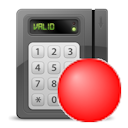 - Reader is
Disabled (or Shunted) - Reader is
Disabled (or Shunted)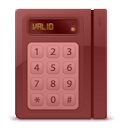 - Reader is
Offline - Reader is
Offline - Reader is
showing a Warning - Reader is
showing a Warning- The Enabled and Disabled status colors are configurable and
their status indicator can be shown or hidden.
|
|
| Input pin |
 - Input in Normal
state - Input in Normal
state - Input in Active
state - Input in Active
state - Input in Trouble (short
circuit) or Trouble (open circuit) state - Input in Trouble (short
circuit) or Trouble (open circuit) state - Input in Unavailable
state - Input in Unavailable
state- The state colors are configurable, and the icon can be shown or hidden
depending on the state.
Intrusion inputs with defined types:
 - Burglary-type intrusion
input - Burglary-type intrusion
input- - Door-type intrusion
input
 - Fence-type intrusion
input - Fence-type intrusion
input - Fire-type intrusion
input - Fire-type intrusion
input - Gas-type intrusion
input - Gas-type intrusion
input - Motion-type intrusion
input - Motion-type intrusion
input - Panic-type intrusion
input - Panic-type intrusion
input - Virtual-type intrusion
input - Virtual-type intrusion
input - Window-type intrusion
input - Window-type intrusion
input |
|
| Intrusion detection area |
 - Intrusion
detection area - Intrusion
detection area- The different states are:
- Disarmed (not ready)
- Disarmed (ready to arm)
- Arming
- Perimeter armed
- Master armed
- Alarm active
- The state colors are configurable, and the icon can be shown or hidden
depending on the state.
|
|
| KML object
|
- Can be anything displayed as a clickable transparent layer over a
georeferenced map.
|
- Overlay static features on maps, such as city boundaries, roads, and
hydrographic features.
- Can represent dynamic information, such as weather conditions and traffic
flow, by refreshing the map layer at regular intervals.
|
| Layout |
 - Layout - Layout- A map object that is linked to a previously saved Monitoring task layout.
|
- Display all monitored cameras as a sequence in a tile bubble.
- Double-click to display all the cameras in separate tiles in the
Monitoring task. If the map is displayed in a tile, it
isn’t replaced if the tiles are full.
|
| Map link |
- Map thumbnails, text, icons, images, or colored geometrical shapes.
|
- Click to switch to the linked map.
- Enables map navigation without using the Maps toolbar.
- Useful when the map is displayed in the Monitoring
task.
Note: If Display alarms from linked maps is enabled in the
map options, the number of active alarms on a linked map is shown on the link to
that map.
|
| Mobile user |
 - Mobile user with no
picture - Mobile user with no
picture
|
- When Share location is enabled on
Genetec™ Mobile devices, this map object shows the locations of mobile users and
lets you message them and share entities.
- Point to the bubble to show the Security Center SaaS username.
- The bubble displays the user's picture, if available.
|
| Output relay |
 - Output relay in
Normal state - Output relay in
Normal state - Output relay in
Active state - Output relay in
Active state - Output relay in
Unknown state - Output relay in
Unknown state
|
|
| Records |
- Records are data structured according to a given record type and intended to enhance
situational awareness or add context to your maps. The display of records on
maps is controlled by the .
 - Default representation with
the first letter of the record type name - Default representation with
the first letter of the record type name - Custom representation with
user-selected color and icon - Custom representation with
user-selected color and icon- Records can also be represented as colored polygons.
|
- Click the pin or the polygon to view the record details in an information
bubble.
- Right-click anywhere on the map and then select Add new data on
map. A dialog box opens in which you can add a record using a
preconfigured record type at the position you clicked. This only works for
record types managed by Record Caching Service roles.
|
| Text, images and geometrical shapes
|
- Text, icons, images, and colored shapes (polygons and ellipses)
|
- These can be added to maps to provide additional information, indicate the
location of points of interest, or serve as map links or alarms. For example,
one usage might be to indicate the location of wall-mounted scanners on a
department store floor plan.
|
| Zone |
 - Zone - Zone - Virtual zone - Virtual zone - I/O zone - I/O zone- The different states are: Disarmed, Normal, Active, and
Trouble.
- The state colors are configurable, and the icon can be shown or hidden
depending on the state.
|
|
