Adjusting the information displayed on maps

2026-10-01Last updated

To avoid obstructing important map details, you can adjust a layer’s opacity and set map object icons to automatically scale with the zoom level.

What you should know

Use these settings to reduce map clutter and improve the visibility of important map information. Genetec™ Operation users cannot change a map layer’s opacity or enable auto-scaling; these settings can only be configured from Genetec™ Configuration.

Procedure

  1. In the Map designer menu, click Map > Layers .
  2. Point to the layer you want to change, and click the cogwheel ().
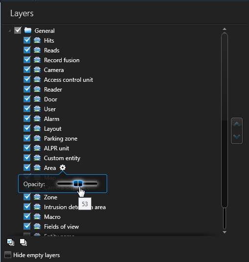
    The Layers menu in the Map Designer, with multiple layers selected. The settings menu for the Area layer is open, with the opacity of the layer set to 53.
  3. In the widget that opens, drag the Opacity slider until you get the desired effect on the map.
  4. To control when map objects are visible, configure the Visible from zoom percentages.
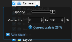
    The Layers menu in the Map Designer, with the Camera layer selected, and the settings menu open.
    Use visibility thresholds to specify when a map object layer is displayed or hidden as users zoom in and out.
  5. Optional: SelectAuto scaleto automatically scale map objects on the layer as users zoom in and out.
    Note:
    Auto scale is only available on geographic and georeferenced image maps. For more information on how to georeference a map, see Georeferencing a map image
  6. Repeat with other layers if necessary.
  7. In the Map designer toolbar, click Save ().