
Adjusting the information displayed on maps
2026-03-25Last updated
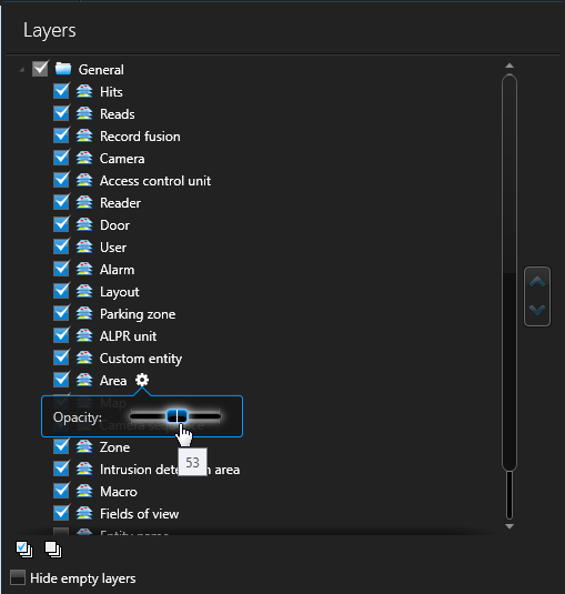
To avoid obstructing important map details, you can adjust a layer’s opacity and set map object icons to automatically scale with the zoom level.
What you should know
Procedure
-
Point to the layer you want to change, and click the cogwheel (
 ).
).
-
Control when map objects are visible on a map by doing one of the following:
- Set the Visible from zoom percentages to create a threshold
for when a map object layer is visible or hidden from view.
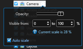
- Select the Auto scale option to have the map objects on a
given layer automatically scale up or down depending on the zoom distance.Note:Auto scale is only available on geographic and georeferenced image maps. For more information on how to georeference a map, see Georeferencing a map image.
- Set the Visible from zoom percentages to create a threshold
for when a map object layer is visible or hidden from view.
-
In the Map designer toolbar, click
Save (
 ).
).